The Pacific Ocean is the largest ocean in the world. There are many small islands scattered here and there. Some of these are very molecular in nature. Because of this, they have a very high tourist attraction. Most of them show tropical characteristics, so they are very similar to Sri Lanka in terms of climate.
A tiny dot on the world map, almost invisible, the island of Tahiti is perfect in all the aforementioned ways regarding the islands of the Pacific Ocean. Due to the very small area, one may think that it is a futile task to go there, but when you see the beautiful beaches there, you will undoubtedly feel that it is a difficult task to leave it again.
Location and basic information of Tahiti
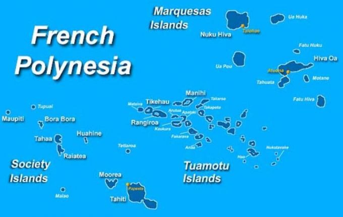
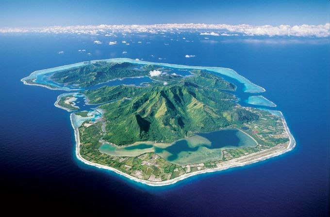
Tahiti, under the rule of France, belongs to French Polynesia. This is the largest island in the Windward Islands and is the result of two contiguous, now inactive Yamahal portals rising out of the ocean. The area around the large Yamahala gate is called Tahiti Nui, and the area around the small Yamahala, which is like a peninsula, is called Tahiti Iti. The string that connects these two together is called ‘Tarao’.
Islands of French Polynesia, including Tahiti
The total area of the island of Tahiti is 403 square miles, or 1,043 square kilometers. This includes more than a third of the total land area of French Polynesia. The largest city and capital here is Papeete, located on the northwest coast.
Topography and Climate of Tahiti
Although Tahiti is a small island, it has a mountainous topography because it is formed by two portals protruding from the sea in a subterranean mahal system. The highest point in the Tahiti Nui section is Mount Orohena at 2,237 meters, while the highest point in Tahiti Iti is Mount Roinu at 1,323 meters. Tahiti is rich with many small streams that originate from these, the largest of which is the ‘Papenu’ which flows in a northerly direction.
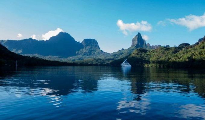
Tahiti inherits a beautiful topography
Tahiti is generally an island with good rainfall. It can also be divided into two main zones considering the rainfall. It is the wet southern part and relatively dry northern part. The southern part receives more than 2500 mm of rain annually and the northern part receives about 1800 mm of rain annually. The rainy season is considered to be between December and March. The average daily temperature in coastal areas is around 24 degrees Celsius in June and 29 degrees Celsius in January.
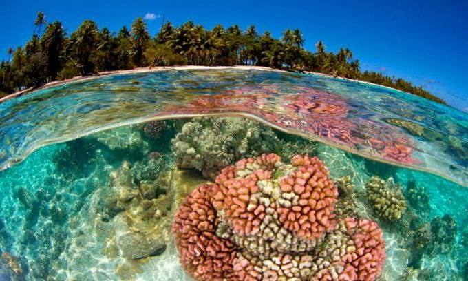
Coral reefs around the island of Tahiti
Tahiti’s climate is ideal for coconut cultivation as well as sugarcane and coffee cultivation. Here, the coastal lagoons are dotted with coral reefs. In addition to this, coconut trees and other tropical fruit trees can be seen along the coast.
History of Tahiti
Polynesians have lived in Tahiti since ancient times. In the 18th century AD, European sailors have arrived here, and the Englishman James Cook takes a major place in it.
Captain James Cook
However, it was France that confirmed the right of this later. The first European settlement was established here in 1797 AD and there have been some political conflicts with the native people. Tahiti was officially declared a French colony in 1880.
Tourist places
Although very small in size, Tahiti and its outlying islands have many tourist attractions.
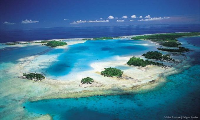
The Rangiroa Coral Islands are considered to be one of the largest coral islands in the world and are famous for diving and boating.
Rangiroa Coral Islands
Ruturu Island, formed by a volcanic eruption about 12 million years ago, is another unique topographical feature of Tahiti. Due to soil erosion, cave-like structures have been formed here. Tourists can also watch whales here
Huahine Island is a 40-minute flight from Tahiti Island and is almost completely covered by forest cover. Plants such as coconut, banana and vanilla can be seen here.
Huahine Island
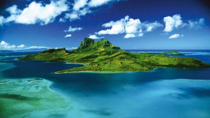
Mount Otemanu is located in Bora Bora, a small island belonging to the island of Tahiti, and it has a special shape. Tourists can also do adventure activities like going to climb this which has a passive yamahal portal.
Opunohu Bay is located on the island of Moorea in French Polynesia and its coastline stretches for 3 kilometers. The sea here is generally not too rough and dolphin watching is also possible.
Opunohu Bay (Dom Leoture)
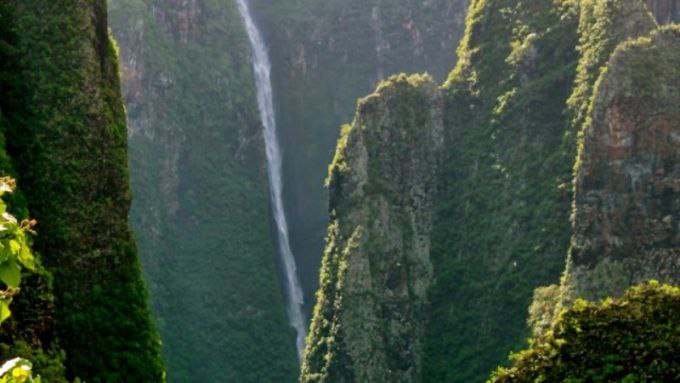
Another small group of islands, the Marquesas Islands are a paradise full of natural wonders. This is a place where there are not only mountains but also waterfalls. Waipo waterfall located on that island is 350 meters high and it is considered to be the third highest waterfall in the world.
Waipo Falls
The highest peak of Moorea Island, which is located close to Tahiti, is Tohivia with a height of 1207 meters and it is also possible to organize a walk around it. Like other islands in French Polynesia, this island is also built due to an underground cave, and because it is built with a topography consisting of many mountains and hills, it manages to steal the eyes of tourists.


